California Commuting Patterns
This data set contains data on modes of transportation to work for Californian Residents aged 16 years and older. Data is from the U.S. Census Bureau, Decennial Census and American Community Survey. The data can be found at the California Health and Human Services Open Data Website.
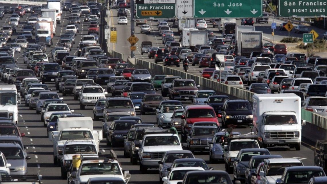
According to the source, "Commute trips to work represent 19% of travel miles in the United States," with cars being by far the most used mode of transportation. While cars are convenient, they are one of the deadliest modes of transportation and release harmful emissions into the atmosphere. According to the California Air Resources Board, vehicles and cars account for approximately one-third of all of California's CO2 emissions and air pollutants.
Besides driving, commuters can take public transportation, bike, walk, work from home, or even carpool. All of these methods help take cars off of our roads, which can significantly cut emissions and save money.
Note that my full report with more analysis is on my GitHub. Some key visualizations:
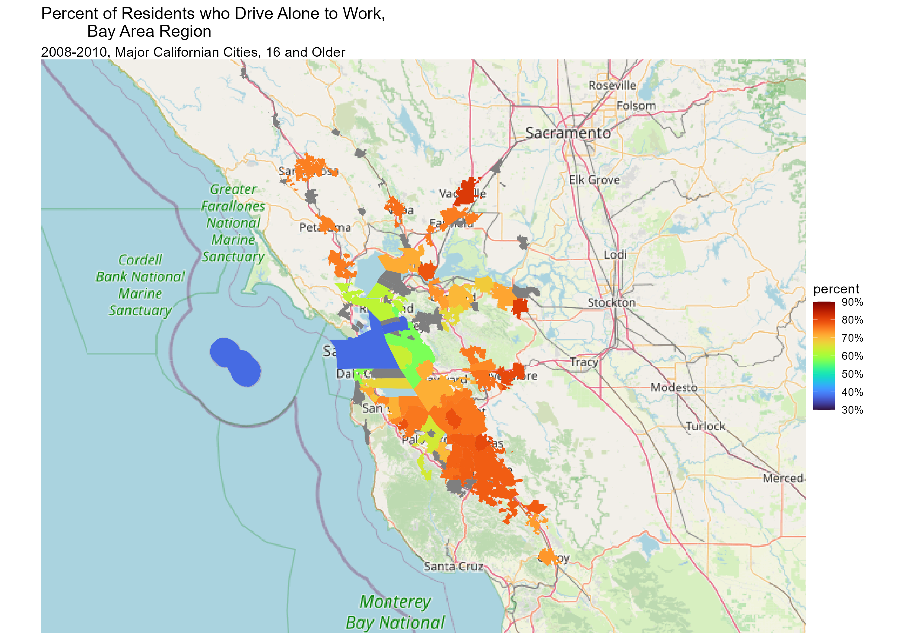
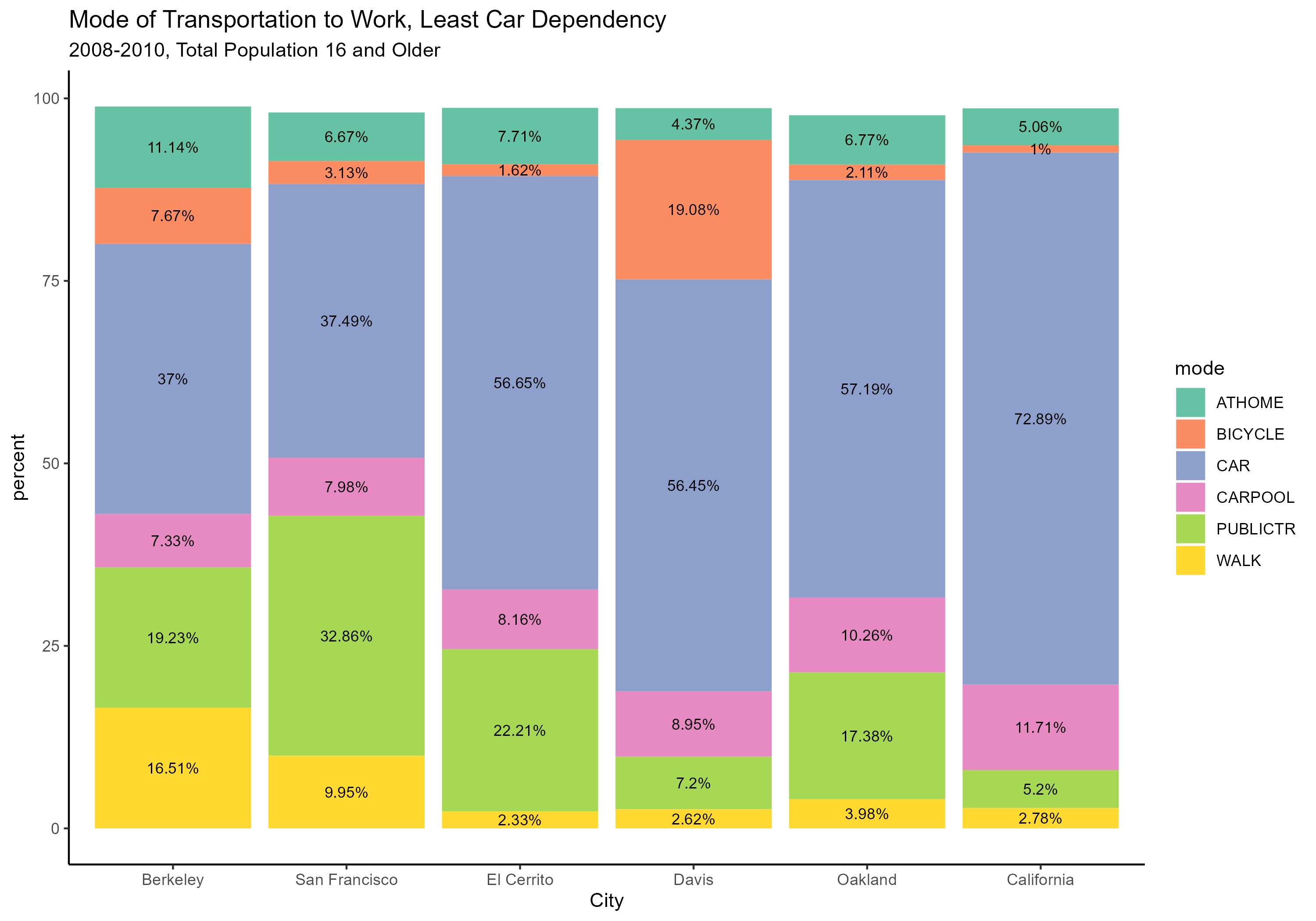
A majority of commuters in Berkeley and San Francisco take public transportation or carpool to work, far above the state-wide averages. It’s also interesting that 19% of commuters in Davis bike to work, then the state average is only 1%.
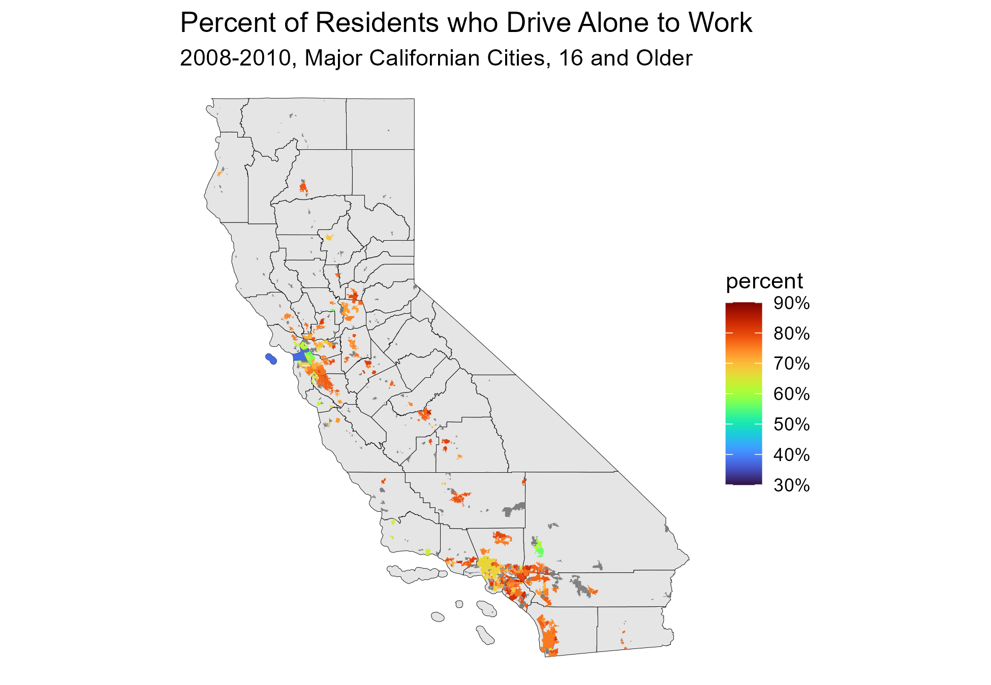
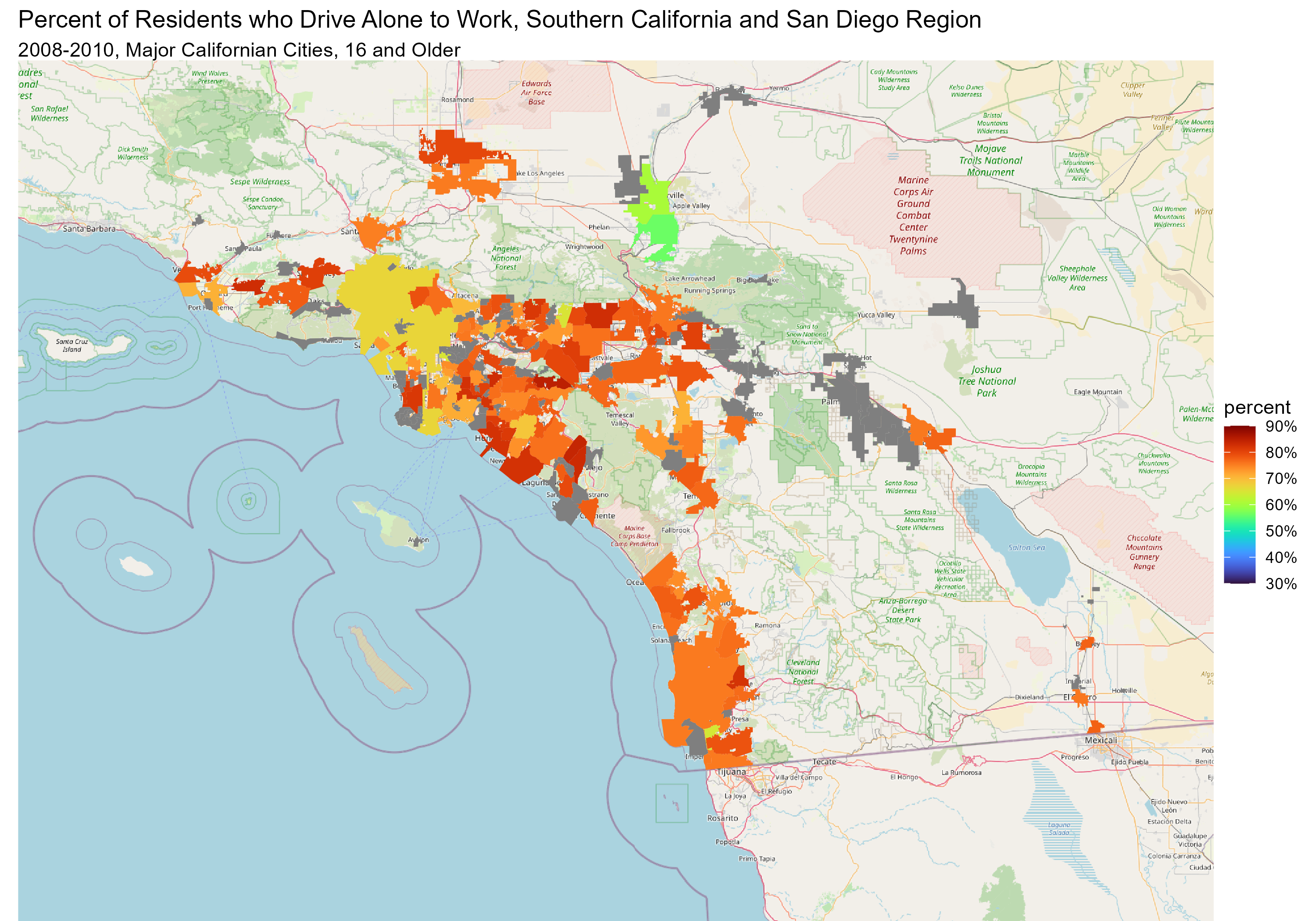
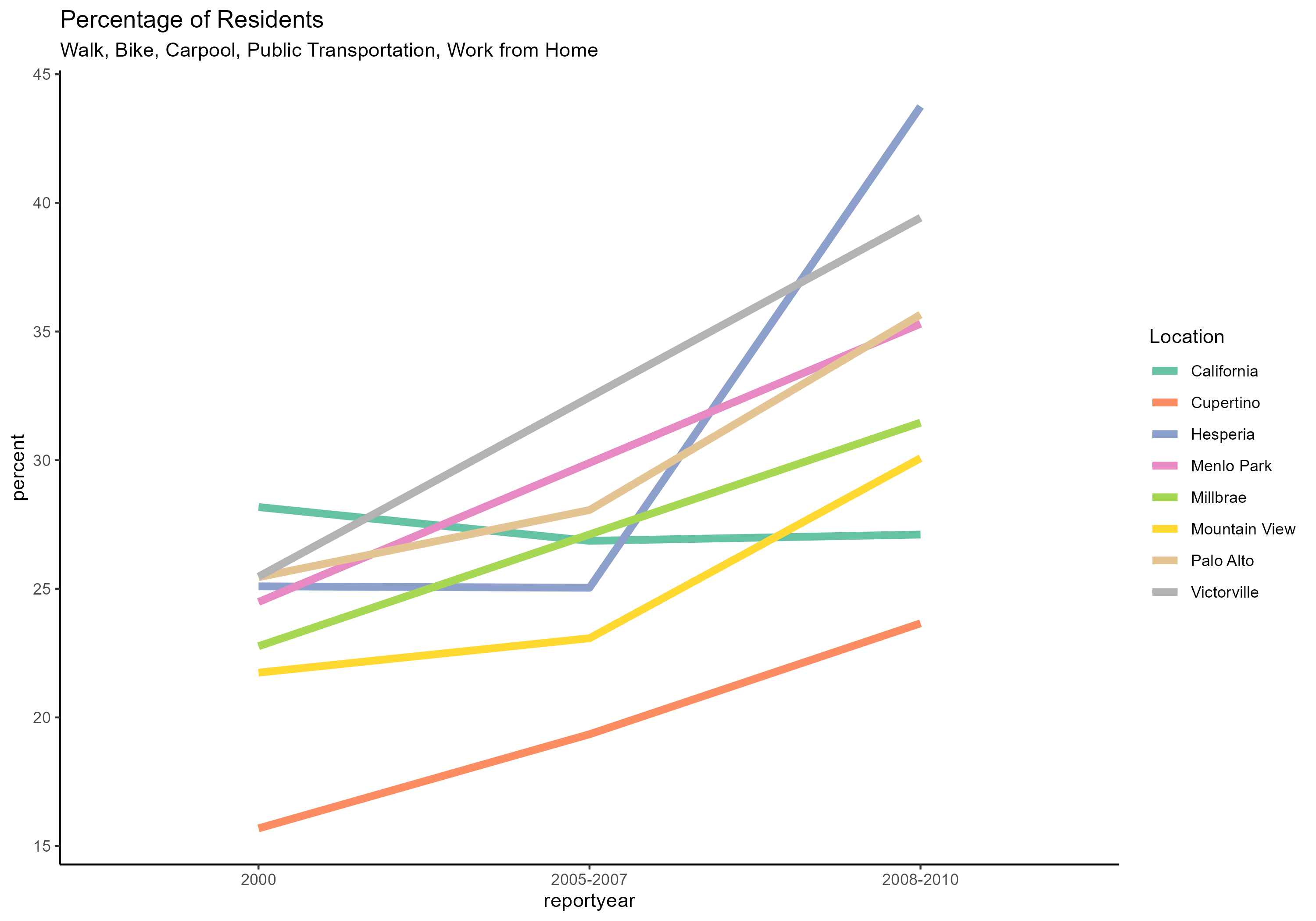
Overall, the percent of Californians taking alternative modes of transportation to work had steadily decreased statewide, and 72.3% of Californians drive alone to work. It's important to note that all of the cities with the fastest transition interestingly all originally had a percentage lower than the state average.
This project was very interesting. I got a lot of practice working with dplyr, graphing locations, organizing data sets, and so much more.
It's important to note that the latest data in this data set is from the 2010 census. Our data also focuses only on commutes for Californians with paid work aged 16 and older. The data excludes driving for school, errands, vacations, and more.
Our analysis of the 200 most populated Californian cities helps shed some light on how car-dependent our state is. Many cities don't have a great public bus system. Others have so few sidewalks that walking or biking to work is just impossible. Still, cities have been improving accessibility to more environmentally friendly and economical modes of transportation.
This data set was accessed from the California Health and Human Services Open Data Website. They provided amazing data dictionaries, narrative examples, and research sources.
Eric C. Anderson's GitHub repository on making maps in R was an incredible source. I used this reference for all of my ggplot maps.
I used this Wikipedia article on Californian counties for more great background information and its tables.